
Planning evacuation routes
If you should ever find yourself in need of evacuation, it’ll help to have planned a suitable route. This is how I do it.
Destinations
In addition to the primary destination, it’s important to have an alternate destination. Preferably in the opposite direction, as this maximizes the chance that the alternate destination remains viable when the primary becomes unreachable. To locate each destination on an MGRS map, consider using GridScout Map™.
Routes
While it’s helpful to know the fastest route, the route most useful here is actually the one that is fastest during peaks of traffic congestion. Think rush hour, with a few bad accidents.
In addition to your primary route to each destination, it’s important to have an alternate route in case the actual situation differs from the one in your imagination. Preferably along a path which has no overlap with the primary route, as this maximizes the chance that the alternate route remains viable when the primary becomes impassable.
As an example, let’s plan two routes from Sonna to Walters Ferry. There aren’t many good options for crossing the Snake River, but we can select bridges near Melba (primary) and Marsing (secondary). Then we can plan two routes which diverge immediately to separate highways and which do not meet at any point until we reach our destination.
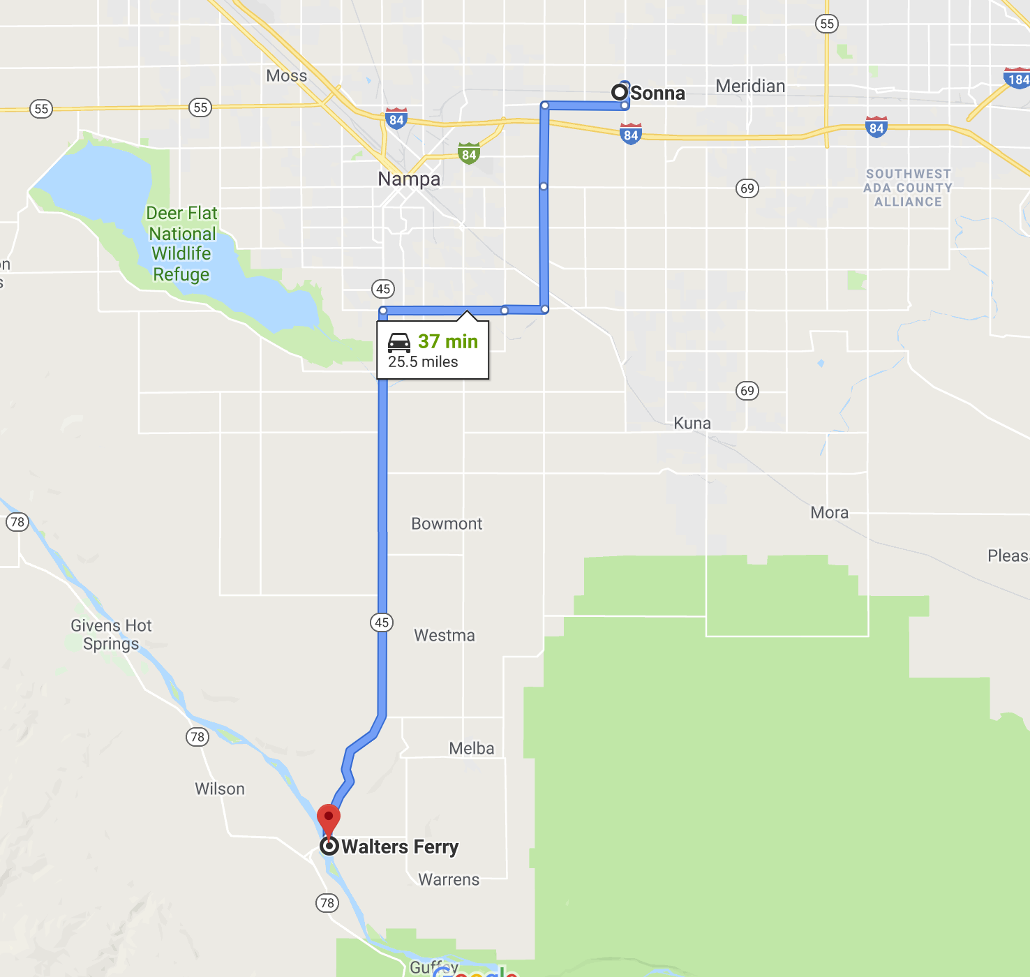
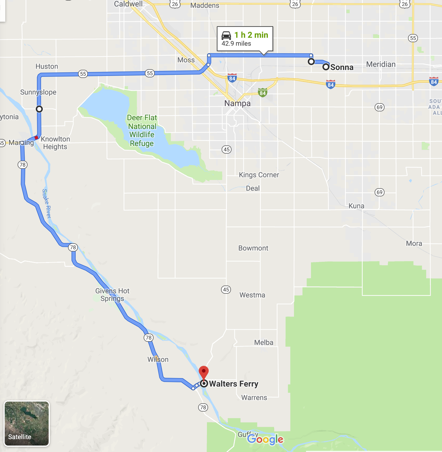 Primary & secondary routes
Zombies don’t stand a chance against such cunning.